
Spartanburg Postal Zone Coverage
County GIS returned five physical-address ZIPs when its Address Points were queried for Inc_Muni = SPARTANBURG. The counts below are County GIS address-point counts on the research date. They are not USPS delivery totals, population totals, or a finding that every address in a ZIP lies inside the City. The mailing ZIP shown last is important because it appears in local government correspondence but was not a physical City address-point ZIP in that query.
| ZIP | Areas covered | Post office | Local note |
|---|---|---|---|
| 29301 | 4,875 physical City address points in the County GIS municipal query | Westside USPS facility, 520 W. Blackstock Road | Facility ZIP is 29301-9996. |
| 29302 | 3,928 physical City address points in the County GIS municipal query | No facility was identified in the research | Physical City-address ZIP in the municipal query. |
| 29303 | 2,121 physical City address points in the County GIS municipal query | No facility was identified in the research | County Administration and elections offices use this ZIP. |
| 29306 | 6,956 physical City address points in the County GIS municipal query | Main USPS facility, 250 S. Church Street | Facility ZIP is 29306-9998. |
| 29307 | 3,663 physical City address points in the County GIS municipal query | No facility was identified in the research | The Spartanburg Vital Records office uses this ZIP. |
| 29304 | Not a physical City address-point ZIP in that GIS query | Mailing and PO-box geography | Used in City and County P.O. Box correspondence. |
Postal delivery labels and a municipal GIS query measure different things. Keep the count type with the number. A County address-point total should not be presented as the number of people, households, or mail deliveries in a Spartanburg postal zone.
Verify a Spartanburg Postal Zone
Use the official USPS address lookup to verify the ZIP for a particular address before using County parcel tools. It is the documented postal check in the local research. Once USPS confirms the address, use that physical location in OneMap or the Assessor for parcel-level context rather than trying to build a ZIP-wide list from a postal label.
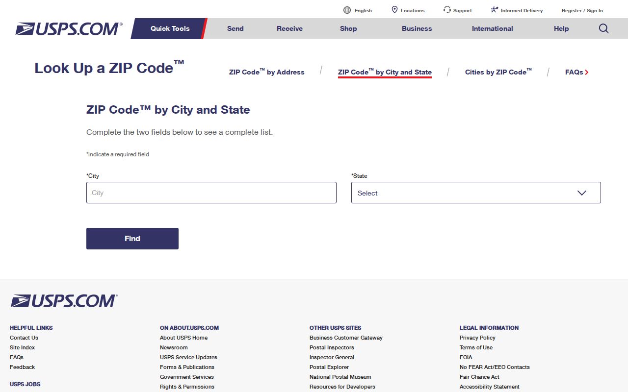
The USPS screen is a useful starting point because ZIP+4 and carrier routes are postal details. They do not identify a parcel owner, a current household, or the legal limits of Spartanburg.
Spartanburg ZIP Codes and City Limits
ZIP codes are USPS delivery geography. Census ZIP Code Tabulation Areas are generalized Census approximations. Neither is a legal City boundary. A broader County query using the MSAGComm = SPARTANBURG addressing attribute produced isolated records in 29349 and 29374, but that community field does not establish physical City ZIP coverage.
For City jurisdiction, Spartanburg directs users to the County Assessor parcel and its Millage Group Z, not the city name printed in an address or the ZIP text. That is the local geography distinction that matters when a record, service, or address appears close to the City but may lie in an unincorporated County area.
Spartanburg Postal Search Fields
OneMap contains postal-community and Post_Code fields in its address-point data, and the technical parcel and address layers can be queried through ArcGIS REST. The regular public OneMap instructions, however, do not document a consumer-facing ZIP filter. The County’s QPublic property application was Cloudflare-blocked during research, so no ordinary Assessor ZIP filter was verified.
| Public County route | Search input | ZIP-related use | Verified limitation |
|---|---|---|---|
| OneMap Search | Parcel Number, Street Name, Address, or Subdivision Name | Use a USPS-verified physical address to reach a map feature | No consumer ZIP search control documented. |
| Find a Parcel | Parcel ID Number or Owner Last Name | Return to a known parcel after ZIP and address verification | Not a ZIP-wide directory. |
| Addressing Inquiries | Road, subdivision, address, or address range | Check the County address form before parcel work | Returns addressing validation, not people. |
| QPublic Assessor application | Live fields not captured | County publishes owner-name and property-address modes | No regular ZIP filter was confirmed. |
The gap matters. A technical data field is not the same as a public search function designed for ZIP-wide resident research. Use the documented address and parcel routes instead of implying that OneMap produces a normal list for an entire postal zone.
Find Spartanburg Residents by ZIP
A ZIP can narrow the physical area, but the verified local process remains address-by-address. It starts with the postal address and ends with the record that matches the question. A parcel owner field, for example, is tax-record context; the recorded deed is the County’s ownership source.
- Enter the complete known address in the USPS lookup and retain the returned postal ZIP as the delivery check.
- Run the road, address, subdivision, or range through County Addressing Inquiries if the address form is uncertain.
- Open the exact location in OneMap and record the Address Points and parcel references from the identified feature.
- Use the County Assessor record for its administrative property context, then verify any ownership question in the Register of Deeds record.
- Check Millage Group Z on the Assessor parcel when the question is whether the location is in the City, rather than assuming the ZIP decides it.
Once a ZIP has narrowed a question to a particular road, the address and deed trail belongs with the Spartanburg Street Directory. ZIP geography remains the postal and geographic filter, not a substitute for that street-level record work.
Spartanburg ZIP Code Directory Limits
The County did not document an ordinary public ZIP filter in its property and GIS interfaces. That means a Spartanburg postal directory cannot honestly claim to return every owner, taxpayer, or resident in a postal zone. OneMap’s address points and parcel fields supply specific-location context after a search, but a map point is not proof of occupancy.
South Carolina’s authenticated MySCVotes voter-information tool also is not a ZIP list. It requires a county, first name, last name, date of birth, and last four digits of a Social Security number for the voter’s own information. The State’s distinct voter-list sale program has qualifying-purchaser and use restrictions. Neither route changes the limits of a single address or parcel record.
Note: Postal verification, parcel context, and official ownership evidence serve different purposes and should be kept separate in a Spartanburg ZIP search.
Spartanburg ZIP Address Changes
County GIS assigns and maintains structure addresses and road data for the 911 system. Its road, subdivision, address, and range checks are the local path for resolving an address form. The City Planning Address Change Request states a three-to-five-day review time for assigning a new parcel address or changing an existing one.
A new address review or a difference between an old directory and a current map should prompt more checking. Compare the road range, parcel, legal description, and recorded deed reference. A changed number or postal detail does not prove that a historical address maps to the same current parcel.
Spartanburg Postal Record Terms
Postal terms and land-record terms sit beside each other in a local address search. Defining them prevents the ZIP from taking on more meaning than it has. The County’s records use physical, tax, and legal identifiers for different tasks.
- ZIP
- A USPS delivery-geography label. It is not a legal City boundary.
- ZIP+4
- An added postal delivery detail that should not be used as a parcel or resident identifier.
- PO-box ZIP
- A mailing ZIP used for post-office boxes or correspondence, such as 29304 in local government mailing addresses.
- Carrier route
- A postal delivery-routing detail, not proof of property ownership or who is at an address.
- Situs address
- The physical property location, distinct from a taxpayer’s mailing address or a deed legal description.
For a transfer trail, the legal description, parcel number, instrument number, and deed book and page are the stronger cross-checks. They are not replaced by the ZIP in a mailing address.
Spartanburg ZIP and Parcel Detail
The most useful local sequence is postal verification, physical-address validation, parcel lookup, then deed confirmation if ownership matters. It is also the safest way to explain a ZIP mismatch. The postal result may be right for delivery while a County parcel remains outside the City or carries a different mailing contact.
OneMap’s Address Points layer holds a full street-name field, address number and suffix, unit and street components, parcel number, incorporated-municipality field, postal community, Post_Code, subdivision, structure type, and coordinates. Those fields make it possible to check location details carefully. They do not create a public list of people by Spartanburg ZIP.
Spartanburg ZIP Neighborhood Names
A ZIP is not a neighborhood name. Spartanburg’s local history supplies neighborhood labels that can help frame a map, directory, newspaper, or deed question, but they do not establish an individual address. The City identifies Hampton Heights as an area of about 375 residences developed from 1890 to 1930 and placed on the National Register in 1983. It also identifies Beaumont Mill Village with a mill founded in 1890 and a local historic designation in 2011.
The City history names South Liberty, Back of College, Highland, Northside, Hamburg, and Gas Bottom among historically Black neighborhoods. County planning history also describes railroad-era expansion, the first Spartan mill in 1888, nine mills in or around the City by 1909, and major downtown change during 1960s and 1970s renewal. Those changes are reasons to check a road range, legal description, and dated source when a historic place name does not line up neatly with a current postal address.